Option A
A secondary stopbank extending from the terrace on Mount Thomas Road to the east of the racecourse
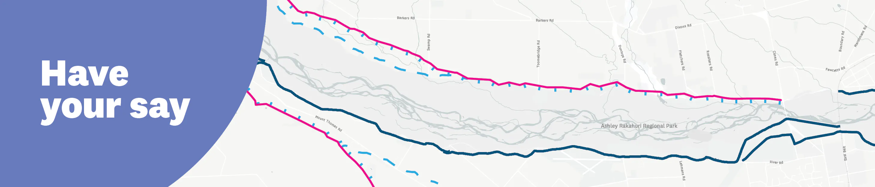
This option would see us building a second stopbank further south of the river, starting at the terrace on Mount Thomas Road and connecting back to the primary stopbank just east of the racecourse. Option A: A secondary stopbank extending from the terrace on Mount Thomas Road to the east of the racecourse
Pros
This provides two levels of protection for the urban areas of Rangiora and Kaiapoi, as well as the rural areas that are currently within the modelled flow paths for breakouts between the Ōkūkū to Rangiora
Cons
This is the longest alignment
The option crosses a significant number of properties
This option wouldn’t improve flood protection for properties in between the primary and secondary stopbanks, and would increase flood depths for some of these properties
Please note that comments you make in this section will appear publicly, so please protect your personal privacy and the privacy of others. Do not share personable or confidential information in this section.
Please remain polite and respectful of others and their opinions. We may remove content that contains: Racism or hate speech, disrespectful, rude, or abusive language, threats to another person or organisation, including us and our employees, potentially defamatory statements, spam or links to external sites, off-topic information irrelevant to the thread, obscene, offensive, harassing, or discriminatory content toward any person or organisation, including us and our employees.

Thank you for your contribution!
Help us reach out to more people in the community
Share this with family and friends