Ashley Rakahuri flood resilience project
Over the next several years, we’re planning to create new flood resilience measures along the 22km section of the Ashley Rakahuri that runs between the Ōkūkū River and Waikuku Beach.
Our goal is to strengthen flood resilience for Rangiora, Kaiapoi, Waikuku, and surrounding areas.
We want your input on the initial options we're considering. Please give your feedback by 10am on 31 August 2026. We’ll be considering your feedback as it comes in, and there will be further opportunities to have your say as the project progresses.
Why we’re doing this work now
Early flood protection works on the Ashley Rakahuri started in the 1930s. The existing stopbank scheme has protected the district for around 70 years, but over that time, the flood risk has increased.
- Recent events, such as the Auckland Anniversary floods and Cyclone Gabrielle, have demonstrated that extreme rainfall and flooding are happening more often and causing greater damage than in the past. Scientific evidence shows these types of events are becoming more frequent and intense.
- There are now more people, homes, businesses and infrastructure located within the Ashley Rakahuri floodplains. This means the consequences of flooding are higher than they were when the scheme was first built. View our flood modelling maps to see the areas that could be affected during a 1‑in‑500‑year flood event.
- Our modelling shows there is a risk of floods breaking out at different points along the river. We want to ensure our flood protection reflects today’s risks and that they are fit for the future.
Our approach
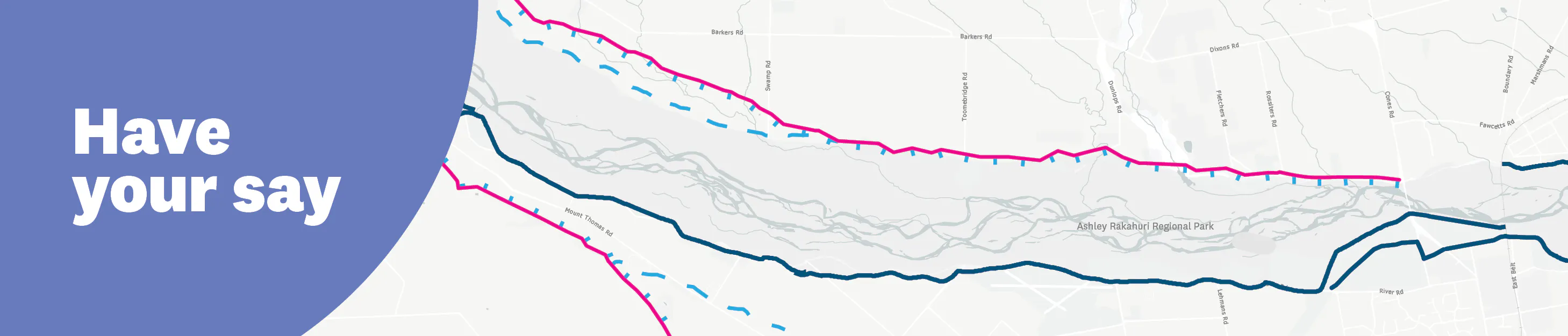
As we follow the Ashley Rakahuri from its confluence with the Ōkūkū River to the coast, the river changes. Flood breakouts can travel in different directions and have different impacts in different places. That's why we're looking at the river in three reaches, each requiring different ways to manage breakout flooding risk.
Reaches:
Ōkūkū confluence → Rangiora Railway Bridge
Railway Bridge → SH1 Bridge
SH1 → the ocean
What options we're considering
We’re considering a range of possible solutions that may be combined. Different approaches may be needed for different parts of the river. These include:
- Upgrading or modifying the existing primary stopbank
- One or more secondary stopbanks
- Managed floodways
- Stopbank retreat
- Berm vegetation management
- Wetland creation / room-for-the-river approaches
- Gravel management
At this early, investigative stage of the project, we have no preferred option/s. Your feedback will help select a preferred option by correcting our assumptions and highlighting unintended consequences. This will be balanced with other criteria such as safety, practicality for land use, environmental and cultural outcomes, feasibility and cost.
Have your say on flood resilience options
- View the current design options for the reach between the Ōkūkū confluence and Rangiora Railway Bridge.
(Design options for downstream reaches will be shared later in 2026.) - Submit feedback. You can provide feedback at any time before 10am on 31 August 2026 or email us directly on rivers.delivery@ecan.govt.nz
- Read more information about the project details, timeline and how decisions will be made.
- View flood modelling maps based on a 1-in-500-year flood event
- Sign up for updates: Join the mailing list in the 'Stay Informed' area of this page
- Ask a question using the questions and answers section. We will email you a reply as soon as possible.
-
Flood modelling maps
These maps show the potential extent and depth of flooding if the Ashley Rakahuri were to breach the primary stopbank at the Ōkūkū confluence and near Smarts Road during a 1-in-500 -year flood event. The Ōkūkū confluence is one of the most likely breakout locations along the primary stopbank, but a flood could break out at any point in the stopbank, as braided rivers are highly dynamic. A breakout could also occur in a smaller flood event, such as a 1-in-100 year event, as erosion rather than overtopping is the cause of breakouts.
The coloured areas on the map indicate where floodwater could travel across the floodplain and how deep the water could become. The different colours on the map represent different estimated water depths in metres. See the colour key on the side of the map. Flood modelling - Upstream of Rangiora
  Flood modelling - Ōkūkū confluence to coast
 How our flood modelling is developed
We use a combination of the following:
Historic breakout data
Updated LiDAR ground levels (remote sensing technology that uses laser lights to determine ground levels)
Recent hydrology and climate information
Different flow scenarios, including rare but high-impact events
Sensitivity testing to understand how water behaves when it breaches stopbanks
Models are peer reviewed internally and will continue to be refined using information from site visits, landowner feedback, and iwi knowledge. The depth ranges shown in the key are estimates based on modelling, not precise measurements at individual properties.